[5:00 AM] The heat returns for today, the first day of astronomical summer, but the higher humidity on Wed. will make it feel much warmer. It will also help fuel a few afternoon/early evening storms, especially south of I-70. Drier/cooler air returns for Thu/Fri. pic.twitter.com/fTp3lG1AJC
— NWS Wilmington OH (@NWSILN) June 21, 2022
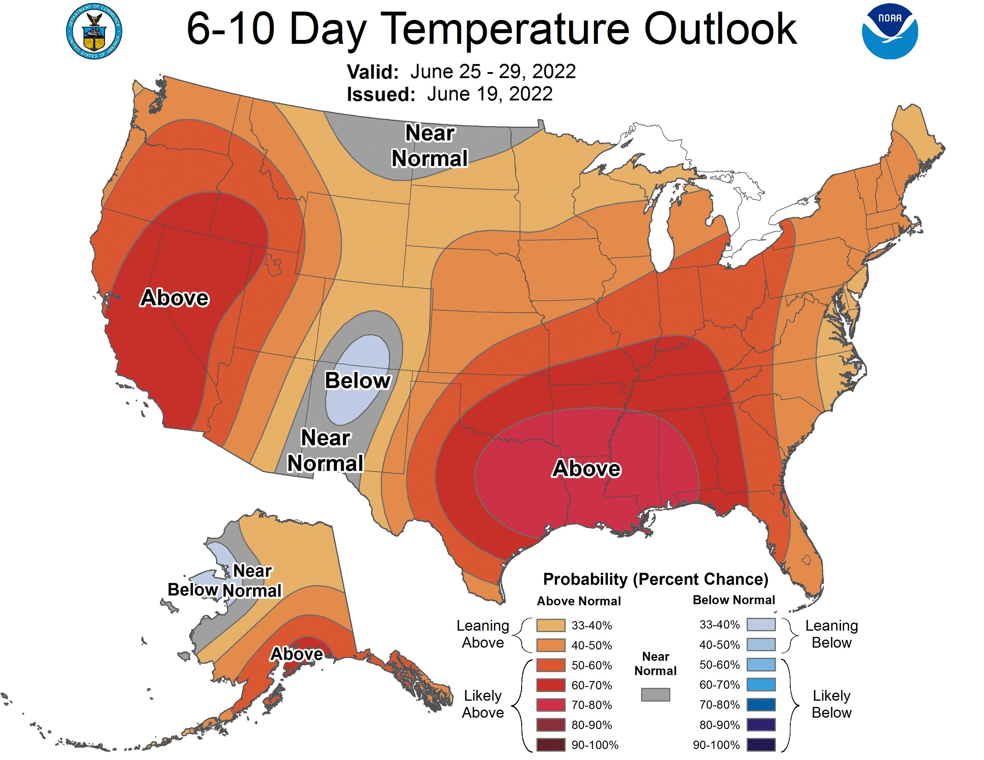
The season is off to a hot start, with this new heat wave coming on the heels of last week’s blast. And the National Weather Service’s Climate Prediction Center also is favoring the likelihood of above-normal temperatures over the months of July, August and September, projecting a 40-45% chance for temperatures to be higher than average.
Today also marks the Summer Solstice — commonly called the longest day of the year — with the sunrise at 6:08 a.m. and sunset at 9:08 p.m., just seconds shy of a full 15 hours.
While similar temperatures will be found Tuesday, the dryness of the air will actually make the apparent temperature (Heat Index) lower in some locations. Wednesday is the most likely day where an advisory would be issued. Advisories for Heat Indexes are 100°-105° in this area. pic.twitter.com/yd4kUF7p7k
— NWS Wilmington OH (@NWSILN) June 20, 2022
After a mild overnight with low temperatures around 70 degrees, the high for Wednesday is predicted in the mid-90s, with a maximum heat index of 102, with numerous hours of heat index between 96 and 102, said meteorologist John Franks at the NWS office in Wilmington.
It will not be quite as muggy as last week, when uncommonly high moisture was present with high temperatures.
However, preliminary maximum heat indices for Wednesday could change depending on the dew point — the temperature to which the air needs to be cooled to achieve 100% relative humidity when the air cannot hold more water in gas form. The higher the dew point, the greater the amount of moisture in the air and the muggier it will feel.
A cold front will cross the area Wednesday afternoon and will bring some relief but in the form of scattered showers and storms. The chance of rain continues before dusk Wednesday, but there is only a marginal risk of severe thunderstorms, according to the NWS Storm Prediction Center.
The front on Thursday will sink south of the area, which will see a return to dry but still warm weather for the rest of the week. High temperatures for Thursday and Friday are expected to reach the low 90s before it heats up again with a high around 95 degrees for Saturday.
A heat wave on the heels of last week’s may not seem typical for June, but Franks said there’s not really any one particular period during the summer months for a heat wave to occur.
“My initial guess was that the highest heat indexes would have occurred in the late summer because of the evapotranspiration, enhanced by the local crops, which is particularly corn. They throw a lot of moisture into the air and we get the dew points topping the upper 70s and maybe even lower 80s,” he said. “We had dewpoints in the upper 70s to I believe lower 80s with this last stretch of heat that we had, and the higher temperatures also combined with them to put the heat indexes into those values that we have topping 100.”
Credit: National Weather Service
Credit: National Weather Service


