
Today will be cooler with a chance of rain throughout the day, according to the National Weather Service in Wilmington.
Highs will be around 62 degrees.
After a lull in rain, showers will return in the evening — especially after 9 p.m. — and continue through the night. Overnight lows will be around 53 degrees.
Rain may linger early Wednesday, but will decrease before increasing again later in the morning. Thunder also is possible with the second round of showers.
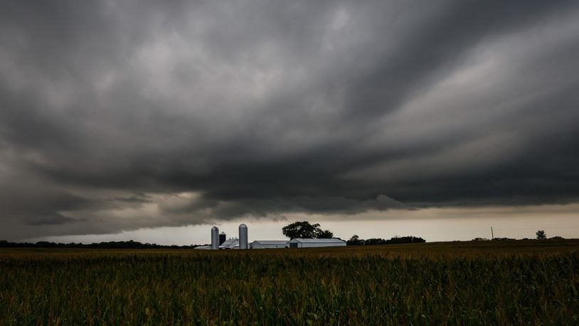
There’s a chance for storms Wednesday afternoon and evening with the possibility that some storms could become strong to severe, according to NWS. The primary time for severe weather is from noon to 5 p.m.
“These storms will pose a damaging wind and large hail risk, and a tornado cannot be ruled out,” NWS reported.
[2:40 PM] We continue to monitor the potential for a few strong to severe storms Wednesday afternoon. These storms will pose a damaging wind and large hail risk, and a tornado cannot be ruled out. Please stay tuned for additional updates as we progress through the next 24 hours! pic.twitter.com/higGzpmSLV
— NWS Wilmington OH (@NWSILN) March 22, 2022
The Dayton area has a slight risk for scattered severe storms, with southwest Ohio having the possibility of isolated severe storms.
The rain and storms will come with breezy winds and stronger gusts of 30 to 40 mph which will continue throughout the day and overnight.
The storms are expected to end around nightfall on Wednesday, though there will still be a chance of rain all night.
Highs will be in the mid 60s to low 70s Wednesday, falling to a low around 46 degrees overnight.
On Thursday, it will be much cooler with a chance of rain throughout the day and overnight hours. It will be breezy during the day, with gusts around 30 mph before the winds calm slightly overnight.
Highs will be around 53 degrees, and lows will be around 38 degrees.
The chance for rain continues Friday into Saturday with the possibility of rain mixing with snow early Saturday. It will be cool Saturday with highs in the mid 40s to low 50s.
About the Author