By the numbers:
$200,000 — Approximate value of one software license provided through AIG
$5.9 million — Estimated value of licenses provided to Greenon overall
$82 billion — Estimated UAV market in the U.S. if UAVs are fully integrated into civilian airspace by 2025.
Sources: AGI, Association of Unmanned Vehicle Systems International
A new course at Greenon High School immerses students in the unmanned aerial vehicle industry, an emerging market that could eventually have an $82 billion impact on the nation’s economy.
Greenon is one of the first in the region to offer the course, which is in its first year, said Sandi Preiss, coordinator for the Dayton Regional STEM Center. The program is designed to expose students to new career opportunities in modeling and simulation, and exposes them to in-demand technology and skills in a variety of industries, including drones.
The Springfield-Dayton region is working to become a major player in the UAV industry, which could create as many as 2,700 jobs in the state and have an $82 billion impact on the nation’s economy by 2025, according to the Association of Unmanned Vehicles Systems International. The Springfield Air National Guard Base remotely pilots Predators and companies such as SelecTech GeoSpatial are exploring commercial drone usage in Springfield.
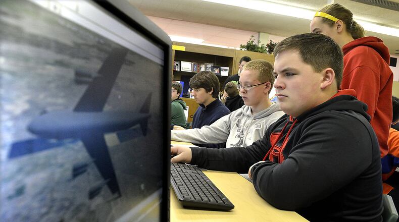
Students in the Science, Technology, Engineering and Mathematics program at Greenon spent Wednesday morning simulating how an unmanned aircraft could monitor situations such as a natural disaster and a military crisis on the west coast.
Throughout the course, the students used software provided by Analytical Graphics Inc., a Pennsylvania firm that develops software for the space, defence and intelligence industries.
“Most kids don’t see this until they’re working on their second or third year of college,” Preiss said.
Not all of the students will be interested in working in the UAV industry after college, said Jim Shaner, one of teachers for the Greenon course. But the goal is to spark an interest in high-tech careers and expose students to new technology.
An initial course earlier this year allowed students to build a model of their school and simulate a fire evacuation plan. This semester, they are using the modeling software to simulate surveillance and response for situations like a natural disaster. Students will eventually create a mobile app that uses data provided by a UAV to plot a safe course for a school bus around a disaster. By the end of the program, students who are interested can also acquire a certification to use the modeling software.
Along with simulating the UAVs in flight, Shaner said students have taken initiative to add new skills on their own. They have learned to make the simulated UAV take off and turn, he said, although it was not required as part of the course.
The program also asks students to study current events to learn about the moral and privacy issues associated with the industry.
“There’s a lot of learning that happens because we spark an interest,” Shaner said.
Kevin Vincent, a Greenon sophomore, was busy simulating a response to a wildfire in Colorado, and tried to program the UAV to drop water on the fire, close a rear hatch and fly away.
“It’s pretty cool to be able to use a computer to help people,” he said.
It typically costs about $200,000 per license for the software used at Greenon, said Stephanie Eftimiades, educational program specialist at AGI. Overall, the total value of the district’s licenses would be about $5.9 million if the district had to purchase it on its own.
AGI has made its licenses available for nonprofit academic work since as early as 1996 to help students become accustomed to using the programs.
“We really want them to have the experience so by the time they enter the workforce they’ve already used it,” Eftimiades said.
The Dayton STEM Center is working with a handful of other districts, including Northmont City Schools and Brookville Local Schools, to offer similar programs, Preiss said.
Exposing students to modeling and simulation technology will prepare them for college, especially as the industry rapidly changes, said Aimee Belanger-Haas, geospatial coordinator at Clark State Community College. Earlier this year, Clark State also unveiled a new degree program to train students in precision agriculture.
The geospatial program can prepare students in a wide variety of fields, Belanger-Haas said, but the use of UAVs to rapidly provide data to analysts on the ground will reduce costs and review the information more quickly.
“It’s a game-changer in the geospatial world,” she said.
Creating simulations of a drone flying over Afghanistan or fighting a wildfire allows students to take concepts like physics and engineering and see how they work in the real world, Shaner said.
“This is the reason they get up in the morning is to come and do this,” Shaner said of the class.
About the Author
