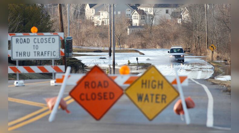
RELATED: Flooding leads to costly projects around Beavercreek
Some properties in Beavercreek may no longer be required to carry flood insurance, while others will have to pick it up as their property now falls within the “1% flood plain,” otherwise known as the 100-year flood plain, according to Beavercreek Associate City Planner Sandra Pereira.
“That’s the focus of the meeting, for those properties that are either being removed or included in the 1% flood plain,” Pereira said.
People who live in flood plains are often required to carry flood insurance coverage, but everyone should consider it, according to Nick Bertke of Marsh & McLennan, Dayton-based insurance company.
“There is a certain misconception that only those in flood zones should purchase flood insurance. Those are people who are typically required to have flood insurance,” Bertke said. “We are seeing a higher frequency of times when there is a sudden heavy rainfall, several inches in a short period of time, and no one is prepared and infrastructure is not designed to handle that type of quick inundation of rain no matter where you’re at.”
New engineering studies have been completed on the Little Miami River, Little Sugar Creek, Beaver Creek and other water ways in Greene County. In addition, maps showing new elevation and topographical data is being incorporated in the newly proposed Flood Insurance Rate Maps.
FEMA Outreach Specialist Laurie Smith-Kuypers said property owners, Realtors and others have an opportunity now to appeal the findings before the maps become effective in the spring 2021.
“The maps are used by (cities) for development decisions and permitting, by lenders and banks, which may have a mandatory purchase requirement for homes that are located into Special Flood Hazard Areas, and by insurance agents, who utilize them to write flood policies,” Smith-Kuypers said.
Flooding from backed-up sewer drains is covered through an add-on to policies, not flood insurance.
Bertke said flood insurance rates can range from a few hundred dollars to thousands of dollars a year.
“Rates are subject to elevation,” he said. “Those who are not in the flood zones can get inexpensive rates compared to those in a flood zone … As we develop areas that weren’t developed in the past, you’re adding more concrete, more drainage systems, it all has to be evacuated somehow, and when you get several inches of rain in an hour, there’s only so much that can be drained.”
Beavercreek, county close to tornado debris removal contract
At 493 claims paying out more than $6.2 million, Butler County has had the most flood insurance claims filed since 1978 compared to Warren, Greene, Clark, Montgomery and Miami counties, according to data curated by the FEMA-administered National Flood Insurance Program.
Montgomery County, which has the highest cost in premiums among those counties, was behind Butler County with 238 claims paying out $1.5 million, according to NFIP.
In Greene County, 194 claims have been filed since 1978, amounting to $1.17 million paid out, according to NFIP.
Greene County currently has 892 policies, 458 in flood plain areas, insuring more than $172,000,000 in property, according to NFIP data.
In Beavercreek, where development has been humming along for several years, the flood plain runs along U.S. 35, and areas closest to the creek are designated floodways and cannot be developed, Pereira said.
For areas in the “1% flood plain,” which used to be referred to as the 100-year flood plain, Pereira said certain regulations “must be adhered to in order to create the least amount of damages due to flooding, which can be very cost prohibitive.”
Pereira said with the latest update to the Flood Insurance Rate Map, “a significant number of properties were removed” and 12 or 13 properties were added to the 1% flood plain.
Beavercreek officials notified those property owners of the Wednesday meeting. and they will have an opportunity to appeal the findings until the summer 2020 when the 90-day appeal period ends.
The maps become effective in spring of 2021, which means some property owners will be required to get flood insurance and others will no longer be required to have it, Pereira said.
“If property owners propose to make improvements, they will be required to adhere to flood plain regulations,” she said. “If their homes are now included, their mortgage company will more than likely require flood insurance.”
FEMA has published an interactive online map showing where changes to the flood risk have been made. For more information, contact FEMA Region V External Affairs at (312) 408-4469.
READ MORE ARTICLES BY THIS REPORTER
What are flood maps used for?
- Identify and assess flood risks
About the Author
