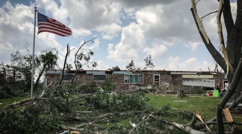
Storm survey teams are working to make measurements that will determine the strength and distance of the tornadoes.
The Enhanced Fujita Scale is the measurement scale used by meteorologists and scientists to determine the strength of a tornado that touches down. >>RELATED: 1 dead from Celina tornado, over 60 storm-related injuries reported at Dayton-area hospitals
EF-0
- Estimated wind speeds: 65 to 85 mph
- Observations: Light damage overall. Winds will pull siding or gutters off homes, broken tree branches, and shallow-rooted trees pushed over.
EF-1
- Estimated wind speeds: 86 to 110 mph
- Observations: Moderate damage. Roofs stripped of shingles. Mobile homes overturned or damaged. Broken glass to windows or other glass
EF-2
- Estimated wind speeds: 111 to 135
- Observations: Considerable damage. Roofs torn off well-constructed homes. Mobile homes completely destroyed. Large trees snapped or uprooted. Cars lifted off ground.
EF-3
- Estimated wind speeds: 136 to 165 mph
- Observations: Severe damage. Well-constructed homes destroyed. Severe damage to large buildings like shopping malls. Heavy cars lifted off the ground and thrown. Trains overturned.
EF-4
- Estimated wind speeds: 166 to 200 mph
- Observations: Devastating damage. Whole frames of well-constructed homes completely leveled. Cars thrown and small missiles generated
EF-5
- Estimated wind speeds: Over 200 mph
- Observations: Incredible damage. Strong frame houses leveled off foundations and swept away. Car-sized missiles fly through the air over 100 yards. High-rise buildings have significant deformation.
The National Weather Service contributed to this report.
In Other News
1
UFC champion Kayla Harrison to return to Middletown for homecoming...
2
Drug operation results in 6 indictments in Clark County
3
Ringing in July 4th with fireworks? Ohio allows it, but many area...
4
Thousands to attend this year’s Summer Music Games: What to expect
5
$1.2M in new state funding released for airport, West Carrollton and...
